Crashes in Cook Shire
live950 of the 415,407 crashes in Road crash locations, Queensland are in Cook Shire, 2001 to 2024. Published by Department of Transport and Main Roads under CC BY 4.0, version 2026-04-24 as at 30 June 2025.
Every reported crash on a Queensland road since 1 January 2001, one row per crash, with its coordinates, severity, road conditions and casualty and vehicle counts. This page holds the rows where council area is Cook Shire. The whole table, with every council area, is Road crash locations, Queensland.
Files for Cook Shire
The rows for this council area alone, cut from version 2026-04-24. Each file carries the publisher's attribution and names the partition it holds.
- cook-shire.json950 rows as JSON
- cook-shire.geojsonthe same rows as GeoJSON
The query API answers the same rows and counts from a URL, in JSON, CSV or NDJSON: rows and aggregate. Every format of the whole table, with a format picker, is on the dataset page.
A sample of 10 rows
From the latest version, newest first by year, then in the publisher's order, with every field. A blank cell is shown as null.
| crash_ref_number | crash_severity | crash_year | crash_month | crash_day_of_week | crash_hour | crash_nature | crash_type | crash_longitude | crash_latitude | crash_street | crash_street_intersecting | state_road_name | loc_suburb | loc_local_government_area | loc_post_code | loc_police_division | loc_police_district | loc_police_region | loc_queensland_transport_region | loc_main_roads_region | loc_abs_statistical_area_2 | loc_abs_statistical_area_3 | loc_abs_statistical_area_4 | loc_abs_remoteness | loc_state_electorate | loc_federal_electorate | crash_controlling_authority | crash_roadway_feature | crash_traffic_control | crash_speed_limit | crash_road_surface_condition | crash_atmospheric_condition | crash_lighting_condition | crash_road_horiz_align | crash_road_vert_align | crash_dca_code | crash_dca_description | crash_dca_group_description | dca_key_approach_dir | count_casualty_fatality | count_casualty_hospitalised | count_casualty_medically_treated | count_casualty_minor_injury | count_casualty_total | count_unit_car | count_unit_motorcycle_moped | count_unit_truck | count_unit_bus | count_unit_bicycle | count_unit_pedestrian | count_unit_other | sa2_2021_code | sa2_2021_name | lga_2025_code | lga_2025_name | sal_2021_code | sal_2021_name | poa_2021_code | poa_2021_name | sed_2025_code | sed_2025_name | ced_2025_code | ced_2025_name |
|---|---|---|---|---|---|---|---|---|---|---|---|---|---|---|---|---|---|---|---|---|---|---|---|---|---|---|---|---|---|---|---|---|---|---|---|---|---|---|---|---|---|---|---|---|---|---|---|---|---|---|---|---|---|---|---|---|---|---|---|---|---|---|---|
| 126696 | Hospitalisation | 2025 | May | Friday | 16 | Angle | Multi-Vehicle | 145.24842684 | -15.4803146873 | Charles St | Hope St | null | Cooktown | Cook Shire | 4895 | Cooktown | Far North | Far Northern | Northern | North Queensland | Cape York | Far North | Queensland - Outback | Remote | Cook | Leichhardt | Locally-controlled | Intersection - Y-Junction | Give way sign | 0 - 50 km/h | Sealed - Dry | Clear | Daylight | Curved - view open | Level | 104 | Vehs Adjacent Approach: Thru-Right | 01: Intersection: Adjacent Approach | S | 0 | 2 | 0 | 1 | 3 | 2 | 0 | 0 | 0 | 0 | 0 | 0 | 315011396 | Cape York | 32500 | Cook | 30675 | Cooktown | 4895 | 4895 | 30021 | Cook | 318 | Leichhardt |
| 182282 | Hospitalisation | 2025 | June | Tuesday | 4 | Hit animal | Other | 143.484762993 | -14.6774225663 | Peninsula Developmental Rd | null | Peninsula Developmental Road (Laura - Coen) | Yarraden | Cook Shire | 4892 | Coen | Far North | Far Northern | Northern | North Queensland | Cape York | Far North | Queensland - Outback | Very Remote | Cook | Leichhardt | State-controlled | No Roadway Feature | No traffic control | 100 - 110 km/h | Sealed - Dry | Clear | Daylight | Straight | Level | 609 | Pass & Misc: Hit Animal | 14: Hit Animal | E | 0 | 1 | 0 | 0 | 1 | 0 | 1 | 0 | 0 | 0 | 0 | 0 | 315011396 | Cape York | 32500 | Cook | 33209 | Yarraden | 4892 | 4892 | 30021 | Cook | 318 | Leichhardt |
| 201924 | Hospitalisation | 2025 | June | Sunday | 11 | Hit object | Single Vehicle | 143.459616997 | -14.6304415644 | Peninsula Developmental Rd | null | Peninsula Developmental Road (Laura - Coen) | Yarraden | Cook Shire | 4892 | Laura | Far North | Far Northern | Northern | North Queensland | Cape York | Far North | Queensland - Outback | Very Remote | Cook | Leichhardt | State-controlled | No Roadway Feature | No traffic control | 80 - 90 km/h | Sealed - Dry | Clear | Daylight | Curved - view obscured | Grade | 803 | Off Path-Curve: Off Cway Rt Bend Hit Obj | 19: Off Carriageway on Curve Hit Object | W | 0 | 1 | 0 | 0 | 1 | 1 | 0 | 0 | 0 | 0 | 0 | 0 | 315011396 | Cape York | 32500 | Cook | 33209 | Yarraden | 4892 | 4892 | 30021 | Cook | 318 | Leichhardt |
| 264905 | Hospitalisation | 2025 | January | Monday | 15 | Hit object | Single Vehicle | 144.800102826 | -16.0391236618 | Mulligan Hwy | null | Mulligan Highway (Mount Molloy - Lakeland) | Lakeland | Cook Shire | 4871 | Cooktown | Far North | Far Northern | Northern | North Queensland | Cape York | Far North | Queensland - Outback | Remote | Cook | Leichhardt | State-controlled | No Roadway Feature | No traffic control | 100 - 110 km/h | Sealed - Wet | Raining | Daylight | Curved - view obscured | Crest | 804 | Off Path-Curve: Off Cway Lt Bend Hit Obj | 19: Off Carriageway on Curve Hit Object | N | 0 | 1 | 0 | 0 | 1 | 1 | 0 | 0 | 0 | 0 | 0 | 0 | 315011396 | Cape York | 32500 | Cook | 31623 | Lakeland | 4871 | 4871 | 30021 | Cook | 318 | Leichhardt |
| 303436 | Hospitalisation | 2025 | February | Friday | 11 | Overturned | Single Vehicle | 144.848377836 | -15.8624766635 | Peninsula Developmental Rd | null | Peninsula Developmental Road (Lakeland - Laura) | Lakeland | Cook Shire | 4871 | Laura | Far North | Far Northern | Northern | North Queensland | Cape York | Far North | Queensland - Outback | Remote | Cook | Leichhardt | State-controlled | No Roadway Feature | No traffic control | 100 - 110 km/h | Sealed - Dry | Clear | Daylight | Straight | Level | 705 | Off Path-Straight: Out Of Control On Cway | 17: Out of Control on Straight | E | 0 | 1 | 0 | 0 | 1 | 1 | 0 | 0 | 0 | 0 | 0 | 0 | 315011396 | Cape York | 32500 | Cook | 31623 | Lakeland | 4871 | 4871 | 30021 | Cook | 318 | Leichhardt |
| 378311 | Hospitalisation | 2025 | June | Tuesday | 8 | Overturned | Single Vehicle | 143.548080974 | -14.9072135722 | Peninsula Developmental Rd | null | Peninsula Developmental Road (Laura - Coen) | Yarraden | Cook Shire | 4892 | Coen | Far North | Far Northern | Northern | North Queensland | Cape York | Far North | Queensland - Outback | Very Remote | Cook | Leichhardt | State-controlled | No Roadway Feature | No traffic control | 100 - 110 km/h | Unsealed - Dry | Clear | Daylight | Straight | Crest | 705 | Off Path-Straight: Out Of Control On Cway | 17: Out of Control on Straight | E | 0 | 1 | 0 | 0 | 1 | 1 | 0 | 0 | 0 | 0 | 0 | 0 | 315011396 | Cape York | 32500 | Cook | 33209 | Yarraden | 4892 | 4892 | 30021 | Cook | 318 | Leichhardt |
| 388241 | Hospitalisation | 2025 | May | Sunday | 8 | Overturned | Single Vehicle | 145.14786783 | -15.6955656823 | Mulligan Hwy | null | Mulligan Highway (Lakeland - Cooktown) | Lakeland | Cook Shire | 4871 | Cooktown | Far North | Far Northern | Northern | North Queensland | Cape York | Far North | Queensland - Outback | Remote | Cook | Leichhardt | State-controlled | No Roadway Feature | No traffic control | 100 - 110 km/h | Sealed - Dry | Clear | Daylight | Straight | Level | 701 | Off Path-Straight: Left Off Cway | 15: Off Carriageway on Straight | S | 0 | 2 | 0 | 0 | 2 | 2 | 0 | 0 | 0 | 0 | 0 | 0 | 315011396 | Cape York | 32500 | Cook | 31623 | Lakeland | 4871 | 4871 | 30021 | Cook | 318 | Leichhardt |
| 411636 | Hospitalisation | 2025 | January | Saturday | 18 | Hit object | Single Vehicle | 141.878836193 | -12.6703664569 | Kerr Point Dr | null | null | Mission River | Cook Shire | 4874 | Weipa | Far North | Far Northern | Northern | North Queensland | Cape York | Far North | Queensland - Outback | Very Remote | Cook | Leichhardt | Locally-controlled | No Roadway Feature | No traffic control | 80 - 90 km/h | Sealed - Wet | Raining | Dawn/Dusk | Straight | Level | 502 | Vehs Overtaking: Out Of Control | 15: Off Carriageway on Straight | E | 0 | 5 | 0 | 0 | 5 | 1 | 0 | 0 | 0 | 0 | 0 | 0 | 315011396 | Cape York | 32500 | Cook | 31864 | Mission River | 4874 | 4874 | 30021 | Cook | 318 | Leichhardt |
| 104432 | Minor injury | 2024 | May | Monday | 17 | Overturned | Single Vehicle | 145.232343837 | -15.5346926866 | Mulligan Hwy | null | Mulligan Highway (Lakeland - Cooktown) | Cooktown | Cook Shire | 4895 | Cooktown | Far North | Far Northern | Northern | North Queensland | Cape York | Far North | Queensland - Outback | Remote | Cook | Leichhardt | State-controlled | No Roadway Feature | No traffic control | 100 - 110 km/h | Sealed - Dry | Clear | Daylight | Curved - view obscured | Level | 804 | Off Path-Curve: Off Cway Lt Bend Hit Obj | 19: Off Carriageway on Curve Hit Object | S | 0 | 0 | 0 | 1 | 1 | 1 | 0 | 0 | 0 | 0 | 0 | 0 | 315011396 | Cape York | 32500 | Cook | 30675 | Cooktown | 4895 | 4895 | 30021 | Cook | 318 | Leichhardt |
| 125451 | Hospitalisation | 2024 | July | Sunday | 9 | Overturned | Single Vehicle | 142.926299101 | -13.4091505221 | Peninsula Developmental Rd | null | Peninsula Developmental Road (Coen - Weipa) | Archer River | Cook Shire | 4892 | Lockhart River | Far North | Far Northern | Northern | North Queensland | Cape York | Far North | Queensland - Outback | Very Remote | Cook | Leichhardt | State-controlled | No Roadway Feature | No traffic control | 80 - 90 km/h | Sealed - Dry | Clear | Daylight | Curved - view open | Level | 801 | Off Path-Curve: Off Cway Right Bend | 18: Off Carriageway on Curve | N | 0 | 1 | 0 | 0 | 1 | 1 | 0 | 0 | 0 | 0 | 0 | 0 | 315011396 | Cape York | 32500 | Cook | 30080 | Archer River | 4892 | 4892 | 30021 | Cook | 318 | Leichhardt |
The 64 fields are described on the dataset page, and schema.xlsx is the data dictionary.
Before you use it
Does it include every car accident in Queensland?
No. It holds the crashes reported to police that met the publisher's criteria, so a minor collision that nobody reported is not here. Property damage only crashes stop after 31 December 2010, and from then on a crash needs a casualty or a tow to be included.
Why are the most recent months lower than expected?
The publisher treats the last 12 months of each release as preliminary, because a police investigation can take up to a year to finalise. The counts for those months rise in later releases.
Where is the Queensland road toll in this data?
Each crash row carries count_casualty_fatality, and the Road casualties table has fatalities counted by year, police region, age group and road user type. The department also publishes a road toll separately and updates it more often, so the two can differ for recent months.
Other council areas
- Aurukun Shire Crashes: 33
- Balonne Shire Crashes: 404
- Banana Shire Crashes: 1,437
- Barcaldine Region Crashes: 348
- Barcoo Shire Crashes: 70
- Blackall Tambo Region Crashes: 144
- Boulia Shire Crashes: 86
- Brisbane City Crashes: 112,251
- Bulloo Shire Crashes: 60
- Bundaberg Region Crashes: 9,108
- Burdekin Shire Crashes: 1,451
- Burke Shire Crashes: 135
- Cairns Region Crashes: 14,041
- Carpentaria Shire Crashes: 185
- Cassowary Coast Region Crashes: 2,815
- Central Highlands Region Crashes: 2,687
- Charters Towers Region Crashes: 1,341
- Cherbourg Aboriginal Shire Crashes: 36
- Cloncurry Shire Crashes: 441
- Croydon Shire Crashes: 49
- Diamantina Shire Crashes: 109
- Doomadgee Aboriginal Shire Crashes: 50
- Douglas Shire Crashes: 1,300
- Etheridge Shire Crashes: 243
- Flinders Shire Crashes: 280
- Fraser Coast Region Crashes: 8,196
- Gladstone Region Crashes: 5,251
- Gold Coast City Crashes: 45,266
- Goondiwindi Region Crashes: 1,070
- Gympie Region Crashes: 5,391
- Hinchinbrook Shire Crashes: 1,024
- Hope Vale Aboriginal Shire Crashes: 33
- Ipswich City Crashes: 17,020
- Isaac Region Crashes: 2,326
- Kowanyama Aboriginal Shire Crashes: 29
- Livingstone Shire Crashes: 2,467
- Lockhart River Aboriginal Shire Crashes: 45
- Lockyer Valley Region Crashes: 3,786
- Logan City Crashes: 27,115
- Longreach Region Crashes: 351
- Mackay Region Crashes: 10,797
- Mapoon Aboriginal Shire Crashes: 13
- Maranoa Region Crashes: 1,164
- Mareeba Shire Crashes: 2,292
- Mckinlay Shire Crashes: 229
- Moreton Bay Region Crashes: 29,777
- Mornington Shire Crashes: 42
- Mount Isa City Crashes: 1,701
- Murweh Shire Crashes: 368
- Napranum Aboriginal Shire Crashes: 24
- Noosa Shire Crashes: 3,992
- North Burnett Region Crashes: 1,338
- Northern Peninsula Area Region Crashes: 104
- Palm Island Aboriginal Shire Crashes: 66
- Paroo Shire Crashes: 175
- Pormpuraaw Aboriginal Shire Crashes: 27
- Quilpie Shire Crashes: 85
- Redland City Crashes: 7,666
- Richmond Shire Crashes: 86
- Rockhampton Region Crashes: 8,507
- Scenic Rim Region Crashes: 3,872
- Somerset Region Crashes: 3,421
- South Burnett Region Crashes: 2,835
- Southern Downs Region Crashes: 2,976
- Sunshine Coast Region Crashes: 24,209
- Tablelands Region Crashes: 2,470
- Toowoomba Region Crashes: 14,880
- Torres Shire Crashes: 76
- Torres Strait Island Region Crashes: 41
- Townsville City Crashes: 16,032
- Unknown Crashes: 599
- Weipa Town Crashes: 66
- Western Downs Region Crashes: 2,865
- Whitsunday Region Crashes: 2,839
- Winton Shire Crashes: 203
- Woorabinda Aboriginal Shire Crashes: 25
- Wujal Wujal Aboriginal Shire Crashes: 2
- Yarrabah Aboriginal Shire Crashes: 119
The licence requires the publisher's attribution. We ask that you also name publicdata.au and link to the version you used.
Department of Transport and Main Roads (2026) Road crash locations, Queensland, version 2026-04-24 [data set], CC BY 4.0, sourced 24 September 2026. Serialised and versioned by National Digital at publicdata.au. Available at: https://publicdata.au/d/qld-road-crash-locations/v/2026-04-24/
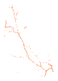
The map's state outlines are from the ABS Australian Statistical Geography Standard 2021, under CC BY 4.0.
Author-date form. The dataset page has the same citation as text, HTML, Markdown and BibTeX.
Department of Transport and Main Roads publishes the whole table on www.data.qld.gov.au. This site cuts these rows from it without changing them. Questions about the content go to the publisher.
Fetched 24 September 2026. Source SHA-256 975be4b02a235d06…